
iPhone 스크린샷
새로운 기능
버전 8.1.8 ·
NEW: Drone Map Lite is included with your subscription. Check where you can fly from any browser on your laptop or desktop at hefferapps.com/drone-map-lite. Get your code in Settings → Unlock the web map. • New drones: Antigravity A1 and the DJI Matrice 3D, 4D and 400 series • Bug fixes and improvements
개발자가 이 내용을 한국어로 제공하지 않았습니다.
App Store 설명개발자가 작성한 내용입니다.
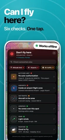
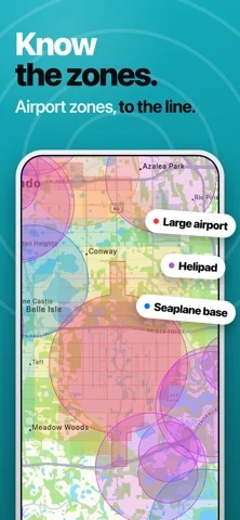
Drone Map & UAV Forecast: The Essential App for Drone Pilots Discover, plan, fly, and organize your drone adventures with Drone Map & UAV Forecast—the all-in-one app built to help drone pilots check airspace, review UAV weather, log flights, find great places to fly, and connect with a worldwide community of pilots. Plan Safer Flights with Airspace Tools Check nearby airspace information, local airports, and no-fly zone data before you take off. Use dedicated flight-planning tools to view restrictions for your current location or search other areas, helping you make safer, more informed flight decisions wherever you plan to fly. Check UAV Weather Forecasts Review UAV weather conditions before launching, including wind, gusts, rain, visibility, humidity, cloud base, GPS signal, and more. Extended forecasts, hourly weather breakdowns, safe-to-fly insights, and detailed forecast data are available with a purchase or active subscription. Log Every Flight Build your personal flight history with an easy-to-use flight log. Record flight duration, altitude, drone, conditions, notes, and flight paths so you can keep track of where, when, and how you fly. Stay Organized Save your favorite drone spots, create custom lists, manage your drone fleet, and build preflight checklists to match your workflow. Keep your locations, drones, checklists, and flight history organized in one place. Find Your Next Perfect Spot Explore drone-friendly locations shared by pilots around the world. Browse the community map, search for and discover spots, filter by country, sort by nearest or highest-rated, view locations on the map, and get directions. Connect with the Drone Community Join conversations about drone spots through comments and replies, share tips, ask questions, and help other pilots discover better places to fly. Like and upvote useful locations and comments, create your pilot profile, and stay up to date through your activity feed. Whether you’re checking airspace information, reviewing UAV weather forecasts, logging flights, organizing favorite locations, or discovering new drone spots, Drone Map & UAV Forecast gives you powerful tools to fly smarter, safer, and with greater confidence. Drone Map & UAV Forecast requires a purchase or active subscription to access the app’s flight-planning tools, weather features, saved locations, flight logs, checklists, community features, and other app content. Download Drone Map & UAV Forecast today and, with a purchase or active subscription, unlock the tools you need to plan better flights, discover better places, and get more from every drone adventure. Terms of Use (EULA): https://www.apple.com/legal/internet-services/itunes/dev/stdeula/
iPhone Duo에서의 Drone Map & UAV Forecast: 자주 묻는 질문
Drone Map & UAV Forecast은(는) iPhone Duo에 최적화되어 있나요?
개발자 또는 스토어가 iPhone Duo 지원을 안내합니다.
Drone Map & UAV Forecast의 가격은 얼마인가요?
Drone Map & UAV Forecast은(는) App Store에서 무료로 다운로드할 수 있습니다.
다른 날씨 앱
모두 보기 ›
중요한 하루의 예보를 따라가는 앱, 모든 Duo 자세에 맞춘 레이아웃

펼친 Duo에서 좌우 분할 레이아웃을 제공하는 차트 중심 날씨 앱

게임에서 영감을 받은 3D 인터페이스와 상세한 예보를 갖춘 날씨 앱

빈정대는 로봇 진행자가 안내하는 날씨 앱, iPhone Duo 지원 추가

호주 기상 경보, 강우 레이더, 하천 수위, 농업인 예보를 보여줍니다.

전문가 폭풍 보도와 인터랙티브 레이더, 시간별 예보를 제공합니다.